色漂镇区
外观
(重定向自瑟普鎮)
| 色漂镇区 ဆိပ်ဖြူမြို့နယ် | |
|---|---|
| 木各具縣鎮區 | |
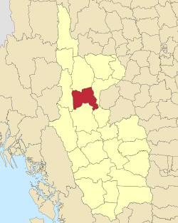
 色漂镇区在馬圭省的位置 | |
| 坐标:21°04′N 94°31′E / 21.07°N 94.52°E | |
| 國家 | |
| 省邦 | 馬圭省 |
| 縣 | 木各具縣 |
| 首府 | 色漂 |
| 面积 | |
| • 总计 | 1,521.0 平方公里(587.3 平方英里) |
| 人口(2014)[1] | 102,769人 |
| • 密度 | 67.57人/平方公里(175.0人/平方英里) |
| 时区 | MST(UTC+6:30) |
色漂镇区(緬甸語:ဆိပ်ဖြူမြို့နယ်,英語:Seikphyu Township[2])為緬甸馬圭省木各具縣的鎮區[3]。2014年人口102,769人[1],區域面積1,521.0平方公里[1]。該鎮下分81個村莊。色漂為該镇区首府。
色漂镇区座標區域範圍於北緯20度51分至21度15分、東經94度09分至94度48分之間。該镇区坐落在堯河東畔[4]。該镇区在2010年10月23日時因氣旋吉里的襲擊而受創[5][6][7]。
該镇区經濟產業以農業為主。在緬甸各地洋蔥市場裡以色漂镇区生產的洋蔥最為知名。
毗鄰
[编辑]與色漂镇区相鄰的地區有[3]:
参考资料
[编辑]- ^ 1.0 1.1 1.2 MYANMAR: Administrative Division (页面存档备份,存于互联网档案馆). Citypopulation. 2015-11-25
- ^ MIMU539v07 12 Dec 12 Myanmar (PDF). [2015-11-25]. (原始内容 (PDF)存档于2013-08-16).
- ^ 3.0 3.1 "Myanmar States/Divisions & Townships Overview Map" (页面存档备份,存于互联网档案馆) Myanmar Information Management Unit (MIMU)
- ^ "Seik Phyu Township - Magway Division" 互联网档案馆的存檔,存档日期2010-11-17. map from Myanmar Information Management Unit (MIMU)
- ^ Reliefweb Updates, Myanmar: Flash floods Hit Pakokku
- ^ Myanmar Information Management Unit (MIMU), UNDP, Map of Cyclone Giri 互联网档案馆的存檔,存档日期2011-06-22.
- ^ DREF Operation Update, Myanmar Cyclone Giri (PDF). [2015-11-25]. (原始内容存档 (PDF)于2016-03-04).
外部連結
[编辑]- Admin map, 2011, Myanmar Information Management Unit (MIMU) (页面存档备份,存于互联网档案馆)
- "Seikpyu Google Satellite Map" (页面存档备份,存于互联网档案馆) map of administrative area with listing of principal settlements, from Maplandia World Gazetteer
- "Seik Phyu Township - Magway Division"[永久失效連結] map, 8 June 2010, Myanmar Information Management Unit (MIMU)


