
File:Benelux schematic map.svg

此SVG文件的PNG预览的大小:430 × 500像素。 其他分辨率:206 × 240像素 | 413 × 480像素 | 660 × 768像素 | 881 × 1,024像素 | 1,761 × 2,048像素。
原始文件 (SVG文件,尺寸为430 × 500像素,文件大小:20 KB)
摘要
| 描述 |
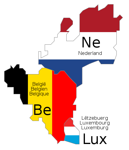
Deutsch: Schematische Karte der Benelux-Länder. Die Länderbezeichnungen sind jeweils in den offiziellen Landessprachen angegeben.
English: Schematic map of Benelux. The country names are given in the official languages of each state.
Français : Carte schématique du Benelux. Les noms des pays sont indiqués dans les langues officielles respectives de chaque état.
Nederlands: Schematische kaart van de Benelux. De landsnamen worden weergegeven in de officiële taal of talen van het betreffende land. |
||||||||
| 日期 | |||||||||
| 来源 | 自己的作品. The schematic design is derived from Benelux.png (released under GFDL), and the flag colors were taken from Flag of Belgium.svg, Flag of Luxembourg.svg and Flag of the Netherlands.svg (both PD) | ||||||||
| 作者 |
|
||||||||
| 授权 (二次使用本文件) |
|
||||||||
| 其他版本 |
|
||||||||
| SVG开发 |


文件历史
点击某个日期/时间查看对应时刻的文件。
| 日期/时间 | 缩略图 | 大小 | 用户 | 备注 | |
|---|---|---|---|---|---|
| 当前 | 2009年6月17日 (三) 10:46 | | 430 × 500(20 KB) | Bibi Saint-Pol | fix internal trouble with text nodes |
| 2009年6月17日 (三) 10:28 |  | 430 × 500(21 KB) | Bibi Saint-Pol | {{inkscape}} {{Information |Description= {{en|1=Schematic map of w:en:Benelux. The country names are given in the official languages of each state.}} {{fr|1=Carte schématique du w:fr:Benelux. Les noms des pays sont indiqués dans les langues of |
文件用途
以下页面使用本文件:
全域文件用途
以下其他wiki使用此文件:
- de.wikipedia.org上的用途
- en-two.iwiki.icu上的用途
- ko.wikipedia.org上的用途
- ru.wikipedia.org上的用途
- uz.wikipedia.org上的用途