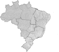
File:Brazil Municipalities.png
外观

本预览的尺寸:676 × 600像素。 其他分辨率:271 × 240像素 | 541 × 480像素 | 866 × 768像素 | 1,155 × 1,024像素 | 1,627 × 1,443像素。
原始文件 (1,627 × 1,443像素,文件大小:207 KB,MIME类型:image/png)
文件历史
点击某个日期/时间查看对应时刻的文件。
| 日期/时间 | 缩略图 | 大小 | 用户 | 备注 | |
|---|---|---|---|---|---|
| 当前 | 2020年3月18日 (三) 04:18 |  | 1,627 × 1,443(207 KB) | ContaDeletada1993 | Brazilian Federal Dis cannot be divided into municipalities. |
| 2019年11月28日 (四) 02:08 |  | 1,627 × 1,443(215 KB) | Allice Hunter | Those divisions weren't municipalities. | |
| 2018年7月26日 (四) 07:05 |  | 1,627 × 1,443(207 KB) | Morta Linda | Update. Distrito Federal cannot be divided into municipalities. According to the Brazilian Constitution, the Federal District assumes the same constitutional and legal powers, attributions and obligations of the states and municipalities. Instead, it is divided by 31 administrative regions that do not have the same function as municipalities. | |
| 2008年1月23日 (三) 18:53 |  | 1,627 × 1,443(215 KB) | Rarelibra | updated map | |
| 2006年12月3日 (日) 03:10 |  | 1,281 × 880(76 KB) | Felipe Menegaz | == Summary == Map of the municipalities of Brazil. Created by Rarelibra 18:34, 24 August 2006 (UTC) for public domain use. Created using MapInfo Professional v8.5 and various mapping resources. == Licensing == {{PD-self}} |
文件用途
以下8个页面使用本文件:
全域文件用途
以下其他wiki使用此文件:
- ar.wikipedia.org上的用途
- ban.wikipedia.org上的用途
- bpy.wikipedia.org上的用途
- br.wikipedia.org上的用途
- ca.wikipedia.org上的用途
- da.wikipedia.org上的用途
- en-two.iwiki.icu上的用途
- eo.wikipedia.org上的用途
- es.wikipedia.org上的用途
- fr.wikipedia.org上的用途
- hu.wikipedia.org上的用途
- id.wikipedia.org上的用途
- it.wikipedia.org上的用途
- ka.wikipedia.org上的用途
- mk.wikipedia.org上的用途
- nds.wikipedia.org上的用途
- pt.wikipedia.org上的用途
- pt.wikisource.org上的用途
- ro.wikipedia.org上的用途
- ru.wikipedia.org上的用途
- sco.wikipedia.org上的用途
- sq.wikipedia.org上的用途
- tr.wikipedia.org上的用途
- uk.wikipedia.org上的用途
- ur.wikipedia.org上的用途
- zh-min-nan.wikipedia.org上的用途


