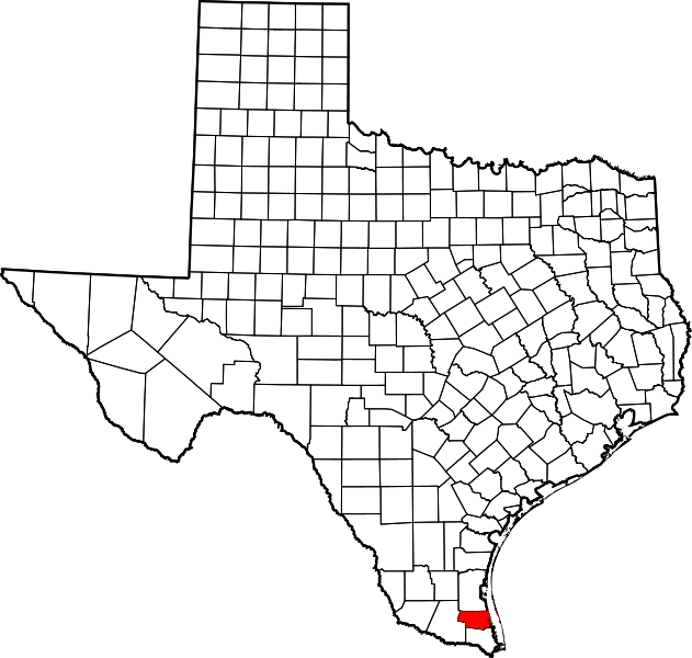
File:Map of Texas highlighting Willacy County.svg
外观

此SVG文件的PNG预览的大小:631 × 600像素。 其他分辨率:253 × 240像素 | 505 × 480像素 | 808 × 768像素 | 1,078 × 1,024像素 | 2,155 × 2,048像素 | 1,386 × 1,317像素。
原始文件 (SVG文件,尺寸为1,386 × 1,317像素,文件大小:222 KB)
文件历史
点击某个日期/时间查看对应时刻的文件。
| 日期/时间 | 缩略图 | 大小 | 用户 | 备注 | |
|---|---|---|---|---|---|
| 当前 | 2024年7月5日 (五) 01:26 |  | 1,386 × 1,317(222 KB) | Nux | fix rendering (remove clipping), uniform colors |
| 2006年2月12日 (日) 17:33 |  | 12,473 × 11,855(304 KB) | David Benbennick | {{subst:User:Dbenbenn/clm|county=Willacy County|state=Texas|type=county}} |
文件用途
以下2个页面使用本文件:
全域文件用途
以下其他wiki使用此文件:
- ar.wikipedia.org上的用途
- be.wikipedia.org上的用途
- bg.wikipedia.org上的用途
- bpy.wikipedia.org上的用途
- ca.wikipedia.org上的用途
- cdo.wikipedia.org上的用途
- ceb.wikipedia.org上的用途
- cs.wikipedia.org上的用途
- cy.wikipedia.org上的用途
- de.wikipedia.org上的用途
- en-two.iwiki.icu上的用途
- List of counties in Texas
- Willacy County, Texas
- Lasara, Texas
- Los Angeles, Willacy County, Texas
- Lyford, Texas
- Lyford South, Texas
- Port Mansfield, Texas
- Ranchette Estates, Texas
- Raymondville, Texas
- San Perlita, Texas
- Santa Monica, Texas
- Sebastian, Texas
- Willamar, Texas
- Zapata Ranch, Texas
- South Padre Island
- Lower Rio Grande Valley
- Old Lyford High School
- Mansfield Cut Underwater Archeological District
查看此文件的更多全域用途。

