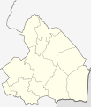
File:Netherlands Drenthe location map.svg
外观

此SVG文件的PNG预览的大小:516 × 599像素。 其他分辨率:207 × 240像素 | 413 × 480像素 | 661 × 768像素 | 882 × 1,024像素 | 1,763 × 2,048像素 | 861 × 1,000像素。
原始文件 (SVG文件,尺寸为861 × 1,000像素,文件大小:87 KB)
文件历史
点击某个日期/时间查看对应时刻的文件。
| 日期/时间 | 缩略图 | 大小 | 用户 | 备注 | |
|---|---|---|---|---|---|
| 当前 | 2009年3月27日 (五) 12:21 |  | 861 × 1,000(87 KB) | Erik Frohne | {{Information |Description={{en|1=Location map of province Drenthe in the Netherlands Equirectangular projection, N/S stretching 166 %. Geographic limits of the map: * N: 53.30° N * S: 52.60° N * W: 6.10° E * E: 7.10° E}} {{de|1=Positionskarte von d |
文件用途
以下2个页面使用本文件:
全域文件用途
以下其他wiki使用此文件:
- ba.wikipedia.org上的用途
- bg.wikipedia.org上的用途
- cs.wikipedia.org上的用途
- de.wikipedia.org上的用途
- de.wikivoyage.org上的用途
- eo.wikipedia.org上的用途
- es.wikipedia.org上的用途
- frr.wikipedia.org上的用途
- fr.wikipedia.org上的用途
- Assen
- Tynaarlo (commune)
- Tynaarlo (village)
- Hoogeveen
- Aa en Hunze
- Borger-Odoorn
- Coevorden
- Emmen (Drenthe)
- Eelde
- Meppel
- Midden-Drenthe
- Noordenveld
- Westerveld (commune)
- De Wolden
- Gasselterboerveenschemond
- Nieuw-Weerdinge
- Eext
- Annerveenschekanaal
- Eexterveenschekanaal
- TT Circuit Assen
- Erica (Drenthe)
- Amsterdamscheveld
- Balinge
- Barger-Compascuum
- Fille d'Yde
查看此文件的更多全域用途。


