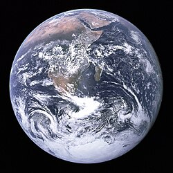
File:The Blue Marble (remastered).jpg
外观
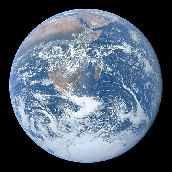
本预览的尺寸:600 × 600像素。 其他分辨率:240 × 240像素 | 480 × 480像素 | 768 × 768像素 | 1,024 × 1,024像素 | 2,048 × 2,048像素 | 3,000 × 3,000像素。
原始文件 (3,000 × 3,000像素,文件大小:5.44 MB,MIME类型:image/jpeg)
文件历史
点击某个日期/时间查看对应时刻的文件。
| 日期/时间 | 缩略图 | 大小 | 用户 | 备注 | |
|---|---|---|---|---|---|
| 当前 | 2024年7月7日 (日) 20:12 |  | 3,000 × 3,000(5.44 MB) | Gabldotink | jpegoptim --keep-all --strip-none --all-normal |
| 2022年2月26日 (六) 14:12 |  | 3,000 × 3,000(5.69 MB) | CactiStaccingCrane | cropped by 2 pixels to get a perfect 3000 by 3000 | |
| 2022年2月16日 (三) 00:59 |  | 3,000 × 3,002(5.3 MB) | Aaron1a12 | Added slight tilt as published by NASA | |
| 2022年2月15日 (二) 23:22 |  | 3,000 × 3,002(4.91 MB) | Aaron1a12 | EV lowered | |
| 2022年2月4日 (五) 21:36 |  | 3,000 × 3,002(5.23 MB) | Aaron1a12 | Uploaded a work by The Crew of Apollo 17 from NASA/JSC/ASU with UploadWizard |
文件用途
以下3个页面使用本文件:
全域文件用途
以下其他wiki使用此文件:
- ab.wikipedia.org上的用途
- ace.wikipedia.org上的用途
- ady.wikipedia.org上的用途
- af.wikipedia.org上的用途
- als.wikipedia.org上的用途
- am.wikipedia.org上的用途
- ang.wikipedia.org上的用途
- ann.wikipedia.org上的用途
- anp.wikipedia.org上的用途
- an.wikipedia.org上的用途
- arc.wikipedia.org上的用途
- ar.wikipedia.org上的用途
- العالم
- الأرض
- قارة
- منطقة زمنية
- مغناطيسية أرضية
- مقياس زمني جيولوجي
- غلاف الأرض الجوي
- مسح الأرض
- خرائطية
- مناخ
- سجل جيولوجي
- طبيعة
- تاريخ الأرض
- تغير المناخ
- يوم الأرض
- كرة أرضية افتراضية
- راية الأرض
- حيوم
- طقس
- تشكل المجموعة الشمسية وتطورها
- جاذبية أرضية
- عمر كوكب الأرض
- خريطة رقمية
- بنية الأرض
- موقع الأرض في الكون
- مستقبل الأرض
- مدار الأرض
- الاقتصاد العالمي
- التاريخ التطوري للحياة
- بيئة طبيعية
- رمز الأرض
- جيولوجيا كواكب النظام الشمسي
- قالب:الأرض
- ar.wikiquote.org上的用途
- ary.wikipedia.org上的用途
查看此文件的更多全域用途。


