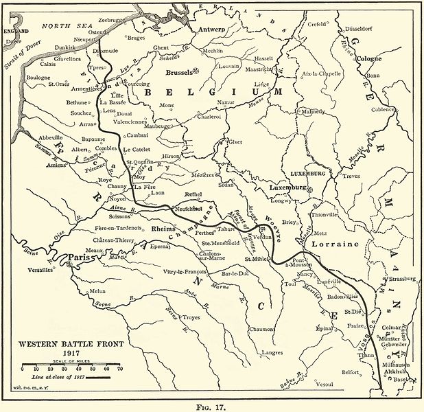
File:WesternFront1917.jpg
外观

本预览的尺寸:618 × 600像素。 其他分辨率:247 × 240像素 | 495 × 480像素 | 792 × 768像素 | 1,144 × 1,110像素。
原始文件 (1,144 × 1,110像素,文件大小:239 KB,MIME类型:image/jpeg)
文件历史
点击某个日期/时间查看对应时刻的文件。
| 日期/时间 | 缩略图 | 大小 | 用户 | 备注 | |
|---|---|---|---|---|---|
| 当前 | 2007年11月6日 (二) 07:53 |  | 1,144 × 1,110(239 KB) | Rcbutcher | {{Information |Description=Map of The Western Front in 1917. |Source=THE GEOGRAPHY OF THE GREAT WAR BY FRANK M. McMURRY, PH.D. New York THE MACMILLAN CO. 1919 <br>Provided with the kind permission of Ms. Darlene McClendon at http://freepages.military.root |
文件用途
以下2个页面使用本文件:
全域文件用途
以下其他wiki使用此文件:
- ar.wikipedia.org上的用途
- en.wikinews.org上的用途
- eo.wikipedia.org上的用途
- fi.wikipedia.org上的用途
- he.wikipedia.org上的用途
- id.wikipedia.org上的用途
- it.wikipedia.org上的用途
- ja-two.iwiki.icu上的用途
- pt.wikipedia.org上的用途
- sr.wikipedia.org上的用途
- sv.wikipedia.org上的用途
- tr.wikipedia.org上的用途
- vi.wikipedia.org上的用途


