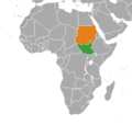
File:South Sudan Sudan Locator-cropped.png
外观

本预览的尺寸:528 × 600像素。 其他分辨率:211 × 240像素 | 422 × 480像素 | 720 × 818像素。
原始文件 (720 × 818像素,文件大小:42 KB,MIME类型:image/png)
文件历史
点击某个日期/时间查看对应时刻的文件。
| 日期/时间 | 缩略图 | 大小 | 用户 | 备注 | |
|---|---|---|---|---|---|
| 当前 | 2020年12月28日 (一) 23:37 |  | 720 × 818(42 KB) | Aquintero82 | Updated map |
| 2016年9月30日 (五) 04:34 |  | 380 × 360(13 KB) | OgreBot | (BOT): Reverting to most recent version before archival | |
| 2016年9月30日 (五) 04:34 |  | 380 × 360(13 KB) | OgreBot | (BOT): Uploading old version of file from en.wikipedia; originally uploaded on 2011-08-11 03:29:45 by Spesh531 | |
| 2016年9月30日 (五) 04:34 |  | 332 × 355(11 KB) | OgreBot | (BOT): Uploading old version of file from en.wikipedia; originally uploaded on 2011-07-11 00:47:06 by Phoenix B 1of3 | |
| 2016年9月28日 (三) 12:09 |  | 380 × 360(13 KB) | XXN | == Licensing == {{self|cc-zero}} Category:Bilateral maps of Category:Bilateral maps of |
文件用途
以下页面使用本文件:
全域文件用途
以下其他wiki使用此文件:
- ar.wikipedia.org上的用途
- en-two.iwiki.icu上的用途
- es.wikipedia.org上的用途
- eu.wikipedia.org上的用途
- he.wikipedia.org上的用途
- it.wikipedia.org上的用途
- pl.wikipedia.org上的用途
- pt.wikipedia.org上的用途
- ru.wikipedia.org上的用途
- www.wikidata.org上的用途

