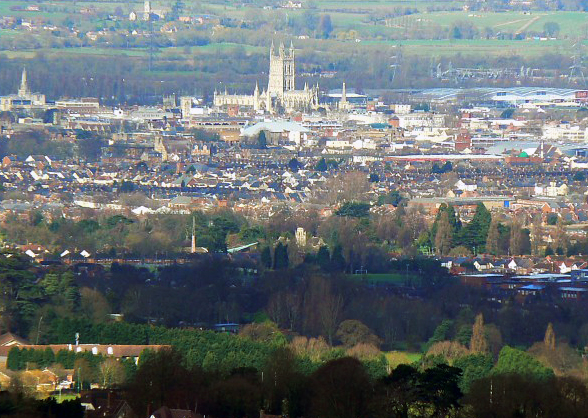
File:Gloucester Skyline.jpg
外觀
Gloucester_Skyline.jpg (588 × 418 像素,檔案大小:341 KB,MIME 類型:image/jpeg)
檔案歷史
點選日期/時間以檢視該時間的檔案版本。
| 日期/時間 | 縮圖 | 尺寸 | 使用者 | 備註 | |
|---|---|---|---|---|---|
| 目前 | 2008年8月12日 (二) 11:05 |  | 588 × 418(341 KB) | Jza84 | auto levels, slight crop, contrast/brightness adjusted slightly |
| 2008年7月28日 (一) 11:29 |  | 640 × 480(114 KB) | Angusmclellan | {{Information |Description=Gloucester Cathedral from Painswick Beacon |Source=From [http://www.geograph.org.uk/photo/720651 geograph.org.uk] |Date=2008-03-09 |Author=[http://www.geograph.org.uk/profile/7420 Brian Robert Marshall] |Permission=Creative Comm |
檔案用途
下列頁面有用到此檔案:
全域檔案使用狀況
以下其他 wiki 使用了這個檔案:
- bg.wikipedia.org 的使用狀況
- fa.wikipedia.org 的使用狀況
- hu.wikipedia.org 的使用狀況
- is.wikipedia.org 的使用狀況
- it.wikipedia.org 的使用狀況
- ja-two.iwiki.icu 的使用狀況
- ms.wikipedia.org 的使用狀況
- nl.wikipedia.org 的使用狀況
- nn.wikipedia.org 的使用狀況
- pnb.wikipedia.org 的使用狀況
- pt.wikipedia.org 的使用狀況
- sk.wikipedia.org 的使用狀況
- sr.wikipedia.org 的使用狀況
- ug.wikipedia.org 的使用狀況
- war.wikipedia.org 的使用狀況
- yi.wikipedia.org 的使用狀況


