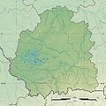
File:Indre department relief location map.jpg
外觀

預覽大小:599 × 600 像素。 其他解析度:240 × 240 像素 | 480 × 480 像素 | 1,020 × 1,021 像素。
原始檔案 (1,020 × 1,021 像素,檔案大小:1.14 MB,MIME 類型:image/jpeg)
檔案歷史
點選日期/時間以檢視該時間的檔案版本。
| 日期/時間 | 縮圖 | 尺寸 | 使用者 | 備註 | |
|---|---|---|---|---|---|
| 目前 | 2016年6月23日 (四) 15:33 |  | 1,020 × 1,021(1.14 MB) | Flappiefh | User created page with UploadWizard |
檔案用途
下列頁面有用到此檔案:
全域檔案使用狀況
以下其他 wiki 使用了這個檔案:
- eo.wikipedia.org 的使用狀況
- Châteauroux
- Issoudun
- La Châtre
- Nohant-Vic
- Valençay
- Ŝablono:Situo sur mapo Francio Indre
- Argenton-sur-Creuse
- Tournon-Saint-Martin
- Reuilly (Indre)
- Celon
- Le Pont-Chrétien-Chabenet
- Chabris
- Éguzon-Chantôme
- Veuil
- Tendu
- Luant
- Luçay-le-Mâle
- Montierchaume
- Neuvy-Pailloux
- Sainte-Lizaigne
- Val-Fouzon
- Saint-Aigny
- Migny
- Buzançais
- Clion (Indre)
- Fléré-la-Rivière
- Saint-Maur (Indre)
- Châtillon-sur-Indre
- Aigurande
- Aize
- Ambrault
- Anjouin
- Ardentes
- Argy
- Arpheuilles (Indre)
- Azay-le-Ferron
- Briantes
- Buxières-d'Aillac
- Champillet
- Chassignolles (Indre)
- Lacs (Indre)
- La Motte-Feuilly
- La Buxerette
- La Berthenoux
- Gournay
- Fougerolles (Indre)
- Feusines
- Crozon-sur-Vauvre
- Crevant
- Cluis
檢視此檔案的更多全域使用狀況。


