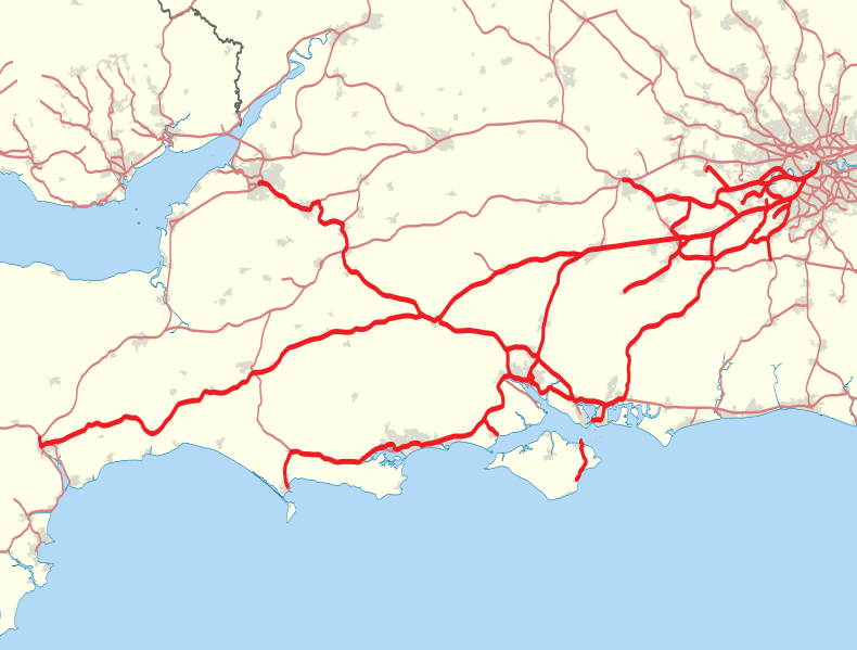
File:South West Trains route map 2010.svg
外觀

此 SVG 檔案的 PNG 預覽的大小:790 × 599 像素。 其他解析度:316 × 240 像素 | 633 × 480 像素 | 1,012 × 768 像素 | 1,280 × 971 像素 | 2,560 × 1,942 像素 | 999 × 758 像素。
原始檔案 (SVG 檔案,表面大小:999 × 758 像素,檔案大小:859 KB)
檔案歷史
點選日期/時間以檢視該時間的檔案版本。
| 日期/時間 | 縮圖 | 尺寸 | 使用者 | 備註 | |
|---|---|---|---|---|---|
| 目前 | 2014年2月2日 (日) 00:39 |  | 999 × 758(859 KB) | Nilfanion | Add Island Line |
| 2011年1月30日 (日) 22:14 |  | 999 × 758(859 KB) | Nilfanion | tweak colour | |
| 2011年1月29日 (六) 21:43 |  | 999 × 758(893 KB) | Nilfanion | {{Information |Description=Map showing railway routes operated by South West Trains in 2010. The background map shows the coast of England and Wales and major urban areas. Equirectangular map projection on WGS 84 datum, with N/S st |
檔案用途
下列頁面有用到此檔案:
全域檔案使用狀況
以下其他 wiki 使用了這個檔案:
- en-two.iwiki.icu 的使用狀況
- fr.wikipedia.org 的使用狀況
- simple.wikipedia.org 的使用狀況
- www.wikidata.org 的使用狀況


