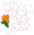
File:Cavally region locator map Côte d'Ivoire.jpg
外觀

預覽大小:583 × 600 像素。 其他解析度:233 × 240 像素 | 466 × 480 像素 | 746 × 768 像素 | 995 × 1,024 像素 | 1,990 × 2,048 像素 | 4,137 × 4,257 像素。
原始檔案 (4,137 × 4,257 像素,檔案大小:1.24 MB,MIME 類型:image/jpeg)
檔案歷史
點選日期/時間以檢視該時間的檔案版本。
| 日期/時間 | 縮圖 | 尺寸 | 用戶 | 備註 | |
|---|---|---|---|---|---|
| 目前 | 2015年12月20日 (日) 05:18 |  | 4,137 × 4,257(1.24 MB) | Good Olfactory | Better format/quality. Map style matches that of departments of same country. More appropriate colour scheme for country (colours from flag). |
| 2015年12月5日 (六) 02:17 |  | 1,444 × 1,513(215 KB) | Good Olfactory | User created page with UploadWizard |
檔案用途
下列頁面有用到此檔案:
全域檔案使用狀況
以下其他 wiki 使用了這個檔案:
- en-two.iwiki.icu 的使用狀況
- es.wikipedia.org 的使用狀況
- ha.wikipedia.org 的使用狀況
- ig.wikipedia.org 的使用狀況
- ja-two.iwiki.icu 的使用狀況
- ts.wikipedia.org 的使用狀況
- ur.wikipedia.org 的使用狀況

