摘要
Library of Congress, http://hdl.loc.gov/loc.gmd/g3910.ct001281
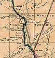
"A map of South Carolina and a part of Georgia. Containing the whole sea-coast; all the islands, inlets, rivers, creeks, parishes, townships, boroughs, roads, and bridges: As also, several plantations, with their proper boundary-lines, their names, and the names of their proprietors. Composed from surveys taken by the Hon. William Bull ... and William De Brahm ... republished with considerable additions, from the surveys made & collected by John Stuart ... by William Faden. London, 1780"
授權條款
此為如實地拍攝平面藝術品的相片複製本。原作位於 公有領域,是因下列原因:
| Public domainPublic domainfalsefalse
|
https://creativecommons.org/publicdomain/mark/1.0/PDMCreative Commons Public Domain Mark 1.0falsefalse
維基媒體基金會的官方立場認為:「針對平面公有領域的藝術作品進行忠實重製,其重製後的照片也屬於公有領域。」 因此,可認定本重製照片屬於公有領域。在其他司法管轄區,再利用此照片可能會被限制; 參見再利用PD-Art照片以獲得進一步資訊。 |
原始上傳日誌
Transferred from en.wikipedia to Commons using For the Common Good.
The original description page was
here. All following user names refer to en.wikipedia.
| 日期/時間 |
尺寸 |
用戶 |
備註
|
| 13:00, 27 June 2007 |
768 × 811 (128,199 bytes) |
w:en:Hughespj (對話 | 貢獻) |
Excerpt of a 1780 map of South Carolina and Georgia. Library of Congress, http://hdl.loc.gov/loc.gmd/g3910.ct001281 "A map of South Carolina and a part of Georgia. Containing the whole sea-coast; all the islands, inlets, rivers, creeks, parishes, townshi
|
| 11:52, 6 September 2006 |
862 × 765 (220,743 bytes) |
w:en:Hughespj (對話 | 貢獻) |
Central Savannah River detail from 'Sketch of the northern frontiers of Georgia, extending from the mouth of the River Savannah to the town of Augusta, by Archibald Campbell', Engraved by Willm. Faden, 1780. LTC Campbell commanded the invasion of Georgia
|


