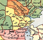
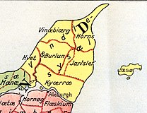
File:Administrative division of denmark in medieval times.jpg
外觀

預覽大小:800 × 583 像素。 其他解析度:320 × 233 像素 | 640 × 466 像素 | 1,024 × 746 像素 | 1,280 × 932 像素 | 2,560 × 1,865 像素 | 5,952 × 4,336 像素。
原始檔案 (5,952 × 4,336 像素,檔案大小:15.8 MB,MIME 類型:image/jpeg)
檔案歷史
點選日期/時間以檢視該時間的檔案版本。
| 日期/時間 | 縮圖 | 尺寸 | 用戶 | 備註 | |
|---|---|---|---|---|---|
| 目前 | 2019年6月12日 (三) 16:30 |  | 5,952 × 4,336(15.8 MB) | Aeroid | removed vertical lines, straight, slight color change |
| 2005年6月19日 (日) 05:36 |  | 5,952 × 4,336(16.87 MB) | Heelgrasper | Administrative division of Denmark in Medieval times. The different colors indicate the division in "sysler" in Jutland while the red lines indicate borders between "herreder" (counties). Dotted red lines indicate never borders. The map is made by profes |
檔案用途
下列頁面有用到此檔案:
全域檔案使用狀況
以下其他 wiki 使用了這個檔案:
- cs.wikipedia.org 的使用狀況
- da.wikipedia.org 的使用狀況
- de.wikipedia.org 的使用狀況
- en-two.iwiki.icu 的使用狀況
- eo.wikipedia.org 的使用狀況
- es.wikipedia.org 的使用狀況
- et.wikipedia.org 的使用狀況
- fi.wikipedia.org 的使用狀況
- frr.wikipedia.org 的使用狀況
- fr.wikipedia.org 的使用狀況
- he.wikipedia.org 的使用狀況
- hu.wikipedia.org 的使用狀況
- id.wikipedia.org 的使用狀況
- it.wikipedia.org 的使用狀況
- ko.wikipedia.org 的使用狀況
- la.wikipedia.org 的使用狀況
- nds.wikipedia.org 的使用狀況
- nl.wikipedia.org 的使用狀況
檢視此檔案的更多全域使用狀況。


