
File:Robinson Crusoe island.png

預覽大小:800 × 560 像素。 其他解析度:320 × 224 像素 | 640 × 448 像素 | 818 × 573 像素。
原始檔案 (818 × 573 像素,檔案大小:613 KB,MIME 類型:image/png)
摘要
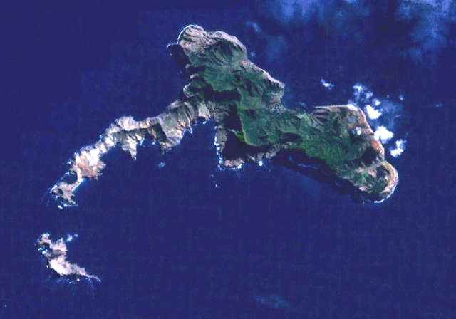
Robinson Crusoe Island (or Más a Tierra or Juan Fernandez island) and Santa Clara Islet (south). Town of San Juan Batista is on the northside. World Wind Landsat visual color.
授權條款
| 本圖像屬於公有領域,因其為NASA的World Wind衛星地圖瀏覽器的一張截圖,且使用了公有領域圖層,如Blue Marble、MODIS、Landsat、SRTM、USGS、GLOBE等。
|
 |
檔案歷史
點選日期/時間以檢視該時間的檔案版本。
| 日期/時間 | 縮圖 | 尺寸 | 用戶 | 備註 | |
|---|---|---|---|---|---|
| 目前 | 2006年3月10日 (五) 16:26 | | 818 × 573(613 KB) | Rasbak | brighter picture |
| 2005年9月29日 (四) 23:27 |  | 818 × 573(626 KB) | Hardscarf | Robinson Crusoe Island (or Más a Tierra or Juan Fernandez island) and Santa Clara islet (south). San Juan Batista is on the northside. World Wind Landsat visual color. Category:Chile Chile {{PD-WorldWind |
檔案用途
下列頁面有用到此檔案:
全域檔案使用狀況
以下其他 wiki 使用了這個檔案:
- arz.wikipedia.org 的使用狀況
- ast.wikipedia.org 的使用狀況
- az.wikipedia.org 的使用狀況
- ceb.wikipedia.org 的使用狀況
- de.wikipedia.org 的使用狀況
- en-two.iwiki.icu 的使用狀況
- es.wikipedia.org 的使用狀況
- et.wikipedia.org 的使用狀況
- eu.wikipedia.org 的使用狀況
- fa.wikipedia.org 的使用狀況
- fr.wikipedia.org 的使用狀況
- he.wikivoyage.org 的使用狀況
- hr.wikipedia.org 的使用狀況
- hu.wikipedia.org 的使用狀況
- it.wikivoyage.org 的使用狀況
- ko.wikipedia.org 的使用狀況
- nl.wikipedia.org 的使用狀況
- nn.wikipedia.org 的使用狀況
- pl.wikipedia.org 的使用狀況
- ru.wikipedia.org 的使用狀況
- sv.wikipedia.org 的使用狀況
- www.wikidata.org 的使用狀況