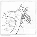
File:FortAdamsMississippiMap.jpg
外观

本预览的尺寸:593 × 600像素。 其他分辨率:237 × 240像素 | 474 × 480像素 | 759 × 768像素 | 1,012 × 1,024像素 | 2,024 × 2,048像素 | 3,871 × 3,916像素。
原始文件 (3,871 × 3,916像素,文件大小:2.08 MB,MIME类型:image/jpeg)
文件历史
点击某个日期/时间查看对应时刻的文件。
| 日期/时间 | 缩略图 | 大小 | 用户 | 备注 | |
|---|---|---|---|---|---|
| 当前 | 2007年12月14日 (五) 11:03 |  | 3,871 × 3,916(2.08 MB) | Allstarecho | {{Information |Description=Map of Fort Adams, Mississippi |Source=http://historicals.ncd.noaa.gov/historicals/histmap.asp?chart=&keyword=&send=Submit+Query&state=MS&type=&year= |Date=June 1864 |Author=From the NOAA Image Archives of the Historical Map & C |
文件用途
以下页面使用本文件:
全域文件用途
以下其他wiki使用此文件:
- en-two.iwiki.icu上的用途


