
File:Gb4dot.svg

此 SVG 檔案的 PNG 預覽的大小:417 × 599 像素。 其他解析度:167 × 240 像素 | 334 × 480 像素 | 534 × 768 像素 | 713 × 1,024 像素 | 1,425 × 2,048 像素 | 1,104 × 1,586 像素。
原始檔案 (SVG 檔案,表面大小:1,104 × 1,586 像素,檔案大小:1,012 KB)
摘要
| 描述 |
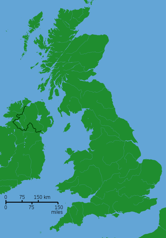
A blank locator map for Great Britain. The idea is to superimpose Image:dot4gb.svg at the appropriate point. See w:Template:GBthumb for code to do this. These two images can replace any locator map posted by Lupin - see w:Special:Contributions/LupinBot. This is a vectorized version of Image:Gb4dot.png, with the scale changed from 200 km to 150 km/150 miles. The shoreline data come from the file gshhs_h.b from the GSHHS, and the rivers and the Irish border come from the CIA World DataBank II; both sources are in the public domain. Mercator projection. |
| 日期 | 2006年8月8日 (原始上傳日期) |
| 來源 | 无法识别来源。根据版权声明推断为其自己的作品。 |
| 作者 | 无法识别作者。根据版权声明推断作者为Wereon。 |
授權條款
| 我,此作品的版權所有人,釋出此作品至公共領域。此授權條款在全世界均適用。 這可能在某些國家不合法,如果是的話: 我授予任何人有權利使用此作品於任何用途,除受法律約束外,不受任何限制。 |
derivative works
Derivative works of this file:
- Great Revolt England 1173.png
- King John's campaign 1215-6.png
- Political map of England 1140.PNG
- Political map of England 1153.PNG
Other versions
-
 A variant with merged paths and alternative colors

檔案歷史
點選日期/時間以檢視該時間的檔案版本。
| 日期/時間 | 縮圖 | 尺寸 | 使用者 | 備註 | |
|---|---|---|---|---|---|
| 目前 | 2006年8月8日 (二) 17:40 | | 1,104 × 1,586(1,012 KB) | Wereon | de-Inkscaped; de-emphasized rivers |
| 2006年8月8日 (二) 17:37 |  | 1,104 × 1,586(1,014 KB) | Wereon |
檔案用途
下列頁面有用到此檔案:
全域檔案使用狀況
以下其他 wiki 使用了這個檔案:
- br.wikipedia.org 的使用狀況
- en-two.iwiki.icu 的使用狀況
- User:IMSoP/sandbox
- User:RHaworth/sandbox
- Talk:Lyme Bay
- Wikipedia:Requests for adminship/RHaworth
- User talk:RHaworth/Archive to 2005 August
- User:Aspro/Sandbox
- User:JamieBattenbo
- User:Lynbarn/Sandbox/templates
- User:Starom
- File:Chailey Heritage Marine Hospital.jpg
- User:Matthuxtable/sandbox/Yelland
- User:Ndsg/Sandbox
- User:PhilipWTVining/Sandbox
- User:Ndsg/Aston Down
- Wikipedia:Village pump (technical)/Archive Z
- User:Joolz/GBthumb2
- es.wikipedia.org 的使用狀況
- fr.wikipedia.org 的使用狀況
- hu.wikipedia.org 的使用狀況
- it.wikipedia.org 的使用狀況
- ja-two.iwiki.icu 的使用狀況
- no.wikipedia.org 的使用狀況
- qu.wikipedia.org 的使用狀況
- sl.wikipedia.org 的使用狀況
- tr.wikipedia.org 的使用狀況
- vi.wikipedia.org 的使用狀況