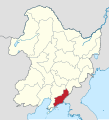
File:Map of Manchukuo divisions 1942 Antung.svg
外觀

此 SVG 檔案的 PNG 預覽的大小:512 × 561 像素。 其他解析度:219 × 240 像素 | 438 × 480 像素 | 701 × 768 像素 | 935 × 1,024 像素 | 1,869 × 2,048 像素。
原始檔案 (SVG 檔案,表面大小:512 × 561 像素,檔案大小:2.26 MB)
檔案歷史
點選日期/時間以檢視該時間的檔案版本。
| 日期/時間 | 縮圖 | 尺寸 | 使用者 | 備註 | |
|---|---|---|---|---|---|
| 目前 | 2024年9月3日 (二) 08:43 |  | 512 × 561(2.26 MB) | Lilauid | == {{int:filedesc}} == {{Information |Description=1942年的安東省 |Source={{own}}<br />{{AttribSVG|Map_of_Manchukuo_divisions_1942.svg}}<br />{{Adobe Illustrator}} |Date=2024-09-03 |Author=Lilauid |Permission= |other_versions={{Template:滿洲國行政區劃}}}} == {{int:license-header}} == {{self|cc-by-sa-4.0}} Category:SVG locator maps of Manchukuo |
檔案用途
下列頁面有用到此檔案:


