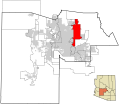
File:Maricopa County Incorporated and Planning areas Scottsdale highlighted.svg
外觀

此 SVG 檔案的 PNG 預覽的大小:694 × 599 像素。 其他解析度:278 × 240 像素 | 556 × 480 像素 | 889 × 768 像素 | 1,185 × 1,024 像素 | 2,371 × 2,048 像素 | 940 × 812 像素。
原始檔案 (SVG 檔案,表面大小:940 × 812 像素,檔案大小:1.05 MB)
檔案歷史
點選日期/時間以檢視該時間的檔案版本。
| 日期/時間 | 縮圖 | 尺寸 | 使用者 | 備註 | |
|---|---|---|---|---|---|
| 目前 | 2011年5月20日 (五) 06:41 |  | 940 × 812(1.05 MB) | Ixnayonthetimmay | Uploading new version |
| 2008年8月30日 (六) 04:39 |  | 900 × 800(413 KB) | Ixnayonthetimmay | == Summary == {{Information |Description=This map shows the incorporated areas and unincorporated areas in Maricopa County, Arizona. [[:en:Paloma, Arizona|Pa | |
| 2007年9月16日 (日) 00:05 |  | 900 × 800(384 KB) | Ixnayonthetimmay | {{Information |Description= |Source= |Date= |Author= |Permission= |other_versions= }} | |
| 2007年5月28日 (一) 10:13 |  | 900 × 780(329 KB) | Ixnayonthetimmay | ||
| 2007年5月22日 (二) 01:15 |  | 900 × 780(318 KB) | Ixnayonthetimmay | ||
| 2007年1月30日 (二) 05:24 |  | 904 × 758(177 KB) | Ixnayonthetimmay | {{Information |Description=This map shows the incorporated areas in Maricopa County, Arizona, highlighting Scottsdale in red. It also shows the boundaries for |
檔案用途
下列頁面有用到此檔案:
全域檔案使用狀況
以下其他 wiki 使用了這個檔案:
- ang.wikipedia.org 的使用狀況
- ar.wikipedia.org 的使用狀況
- arz.wikipedia.org 的使用狀況
- br.wikipedia.org 的使用狀況
- ca.wikipedia.org 的使用狀況
- ceb.wikipedia.org 的使用狀況
- de.wikipedia.org 的使用狀況
- el.wikipedia.org 的使用狀況
- eo.wikipedia.org 的使用狀況
- eu.wikipedia.org 的使用狀況
- fa.wikipedia.org 的使用狀況
- fr.wikipedia.org 的使用狀況
- ga.wikipedia.org 的使用狀況
- glk.wikipedia.org 的使用狀況
- gl.wikipedia.org 的使用狀況
- ht.wikipedia.org 的使用狀況
- hu.wikipedia.org 的使用狀況
- id.wikipedia.org 的使用狀況
- it.wikipedia.org 的使用狀況
- ja-two.iwiki.icu 的使用狀況
- kw.wikipedia.org 的使用狀況
- mg.wikipedia.org 的使用狀況
- ms.wikipedia.org 的使用狀況
- mzn.wikipedia.org 的使用狀況
- pms.wikipedia.org 的使用狀況
- ro.wikipedia.org 的使用狀況
- sr.wikipedia.org 的使用狀況
- sv.wikipedia.org 的使用狀況
- sw.wikipedia.org 的使用狀況
- tr.wikipedia.org 的使用狀況
- tt.wikipedia.org 的使用狀況
- ur.wikipedia.org 的使用狀況
- vi.wikipedia.org 的使用狀況
- vo.wikipedia.org 的使用狀況
- www.wikidata.org 的使用狀況

