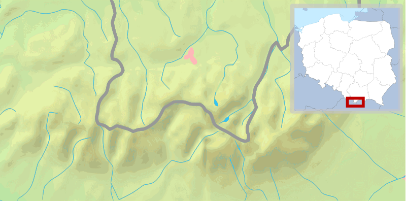
File:POL Tatry.svg
外觀

此 SVG 檔案的 PNG 預覽的大小:800 × 396 像素。 其他解析度:320 × 158 像素 | 640 × 316 像素 | 1,024 × 506 像素 | 1,280 × 633 像素 | 2,560 × 1,266 像素 | 811 × 401 像素。
原始檔案 (SVG 檔案,表面大小:811 × 401 像素,檔案大小:5.36 MB)
檔案歷史
點選日期/時間以檢視該時間的檔案版本。
| 日期/時間 | 縮圖 | 尺寸 | 使用者 | 備註 | |
|---|---|---|---|---|---|
| 目前 | 2009年2月11日 (三) 10:30 |  | 811 × 401(5.36 MB) | Mareklug | pozycjonowanie w górnym rogu na życzenie, ramka (subtelna, półprzezroczysta) / positioning in upper corner on request, border (a suttle, semi-transparent one) |
| 2009年2月11日 (三) 03:19 |  | 811 × 401(5.36 MB) | Mareklug | repositioned the POL white map miniature to the lower right corner, because it was occluding some of Poland. Now both Tatry maps that are national variants use that corner (SVK Tatry.svg & POL Tatry.svg) | |
| 2009年2月10日 (二) 13:32 |  | 811 × 401(5.19 MB) | Mareklug | {{Information |Description={{en|1=Map of the Tatra Mountains}} {{pl|1=Mapa Tatr}} |Source=*File:Tatry_mapa_2.png *File:Poland_location_map_white.svg |Date=2009-02-10 13:28 (UTC) |Author=*File:Tatry_mapa_2.png: ToSter |Dat |
檔案用途
下列頁面有用到此檔案:
全域檔案使用狀況
以下其他 wiki 使用了這個檔案:
- de.wikivoyage.org 的使用狀況
- en-two.iwiki.icu 的使用狀況
- fy.wikipedia.org 的使用狀況
- ko.wikipedia.org 的使用狀況
- pl.wikipedia.org 的使用狀況
- Giewont
- Rysy
- Tatry
- Starorobociański Wierch
- Kozi Wierch
- Liliowe (przełęcz)
- Świnica
- Granaty
- Morskie Oko
- Czarny Staw Gąsienicowy
- Wodogrzmoty Mickiewicza
- Mnich (Tatry)
- Żabi Mnich
- Zadni Mnich
- Niżnie Rysy
- Żabi Szczyt Wyżni
- Żabi Szczyt Niżni
- Żabi Koń
- Mięguszowiecka Przełęcz pod Chłopkiem
- Kazalnica Mięguszowiecka
- Cubryna
- Wrota Chałubińskiego
- Szpiglasowa Przełęcz
- Szpiglasowy Wierch
- Miedziane (Tatry)
- Opalony Wierch
- Gładki Wierch
- Gładka Przełęcz
- Kasprowy Wierch
- Walentkowy Wierch
- Zawrat
- Mały Kozi Wierch
- Zmarzła Przełęcz
- Zamarła Turnia
- Kozia Przełęcz
- Kozie Czuby
- Czarne Ściany
- Orla Baszta
- Buczynowe Czuby
- Krzyżne
- Żółta Turnia
- Roztocka Czuba
- Wierch pod Fajki
- Czarny Staw pod Rysami
- Wielki Staw Polski
- Zadni Staw Polski
檢視此檔案的更多全域使用狀況。


