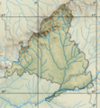
File:Spain Madrid relief map.png
外觀

預覽大小:556 × 599 像素。 其他解析度:223 × 240 像素 | 445 × 480 像素 | 801 × 863 像素。
原始檔案 (801 × 863 像素,檔案大小:766 KB,MIME 類型:image/png)
檔案歷史
點選日期/時間以檢視該時間的檔案版本。
| 日期/時間 | 縮圖 | 尺寸 | 使用者 | 備註 | |
|---|---|---|---|---|---|
| 目前 | 2012年5月8日 (二) 20:21 |  | 801 × 863(766 KB) | Miguillen | |
| 2012年5月8日 (二) 19:58 |  | 801 × 863(769 KB) | Miguillen | ||
| 2012年5月8日 (二) 19:29 |  | 801 × 863(767 KB) | Miguillen | ||
| 2012年5月8日 (二) 19:15 |  | 2,620 × 2,495(6.36 MB) | Miguillen | ||
| 2012年5月8日 (二) 18:12 |  | 801 × 863(769 KB) | Miguillen | ||
| 2012年5月8日 (二) 18:07 |  | 801 × 863(768 KB) | Miguillen | ||
| 2012年5月8日 (二) 17:37 |  | 801 × 863(767 KB) | Miguillen | ||
| 2012年5月8日 (二) 17:21 |  | 2,625 × 2,500(6.35 MB) | Miguillen | == {{int:filedesc}} == {{Information |Description={{en|Location map relief of Community of Madrid}} Equirectangular projection, N/S stretching 130 %. Geographic limits of the map: * N: 41.221046° N * S: 39.804255° N * ... |
檔案用途
下列頁面有用到此檔案:
全域檔案使用狀況
以下其他 wiki 使用了這個檔案:
- an.wikipedia.org 的使用狀況
- ar.wikipedia.org 的使用狀況
- ast.wikipedia.org 的使用狀況
- bg.wikipedia.org 的使用狀況
- ca.wikipedia.org 的使用狀況
- ceb.wikipedia.org 的使用狀況
- ce.wikipedia.org 的使用狀況
- ch.wikipedia.org 的使用狀況
- el.wikipedia.org 的使用狀況
- en-two.iwiki.icu 的使用狀況
- Valdemorillo
- Tumult of Aranjuez
- Open de España
- San Sebastián de los Reyes
- Madrid Open (golf)
- Fuenlabrada
- Peñalara
- Turespaña Masters
- Arganda del Rey
- Open Mahou de Madrid
- Oki Pro-Am
- Madrid Masters (golf)
- Humanes de Madrid
- Navacerrada Dam
- Perales de Tajuña
- Mount Abantos
- Module:Location map/data/Spain Community of Madrid/doc
- Challenge de Madrid
- User:Michael!/Project:Location map templates/Spain
- Lomas Bosque Challenge
- Campeonato de Castilla
- 1965 Canada Cup
- Module:Location map/data/Spain Community of Madrid
- 1970 Eisenhower Trophy
- User:Abune/sandbox
- 1992 World Cup (men's golf)
檢視此檔案的更多全域使用狀況。


