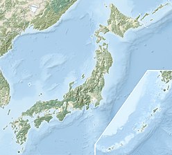
御前澤冰河
外观
| 御前澤冰河 | |
|---|---|
 | |
| 坐标 | 36°34′19″N 137°37′23″E / 36.572°N 137.623°E |
御前澤冰河(日语:御前沢氷河)是日本的冰河,位在富山縣立山主峰雄山的東側斜面,全長約700公尺、面積約0.1平方公里。日本少數現存的冰河,也是黑部川的水源之一[1][2]。2012年,認定為冰河[3]。
脚注
[编辑]- ^ 立山連峰:日本初の「氷河」、学会が認定. 毎日新聞. 2012-04-04 [2012-04-04].
- ^ 国内7カ所目の氷河確認 北アルプス、唐松沢雪渓 (页面存档备份,存于互联网档案馆) 産経新聞 2019年10月4日
- ^ 国内初の現存する「氷河」を立山連峰で発見!. [2023-05-20]. (原始内容存档于2023-05-20).


