跳转到内容

英文维基 | 中文维基 | 日文维基 | 草榴社区

Template:Infobox settlement/testcases

坐标48°4′41″N 123°6′5″W / 48.07806°N 123.10139°W / 48.07806; -123.10139
维基百科,自由的百科全书

人口測試

[编辑]
左右对比
{{Infobox settlement}}{{Infobox settlement/sandbox}}
OX市
面积
 • 总计100 平方公里(40 平方英里)
人口
 • 總計2,0002,000人
 • 密度20人/平方公里(51.8人/平方英里)
OX市
面积
 • 总计100 平方公里(40 平方英里)
人口
 • 總計2,0002,000人
 • 密度20人/平方公里(51.8人/平方英里)
左右对比
{{Infobox settlement}}{{Infobox settlement/sandbox}}
OX市
面积
 • 总计100 平方公里(40 平方英里)
人口
 • 總計2,000人
 • 密度20人/平方公里(51.8人/平方英里)
OX市
面积
 • 总计100 平方公里(40 平方英里)
人口
 • 總計2,000人
 • 密度20人/平方公里(51.8人/平方英里)
左右对比
{{Infobox settlement}}{{Infobox settlement/sandbox}}
OX市
面积
 • 总计100 平方公里(40 平方英里)
人口
 • 總計2,000人
 • 密度20人/平方公里(51.8人/平方英里)
OX市
面积
 • 总计100 平方公里(40 平方英里)
人口
 • 總計2,000人
 • 密度20人/平方公里(51.8人/平方英里)

Case 0: Linares

[编辑]
左右对比
{{Infobox settlement}}{{Infobox settlement/sandbox}}
Linares
City and Commune
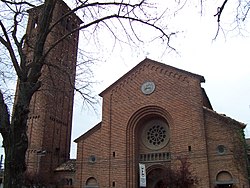
Cathedral of Linares
Flag
旗幟
Coat of arms
徽章
Location in the Maule Region
Location in Chile
Location in Chile
Linares
Location in Chile
坐标:35°51′S 71°36′W / 35.850°S 71.600°W / -35.850; -71.600
CountryChile
RegionMaule
ProvinceLinares
FoundedMay 23, 1794
Founded asVilla de San Ambrosio de Linares
政府[1]
 • 类型Municipality
 • AlcaldeRolando Rentería Möller
面积[2]
 • 总计1,456.7 平方公里(562.4 平方英里)
人口(2002 Census)[2]
 • 總計83,249人
 • 密度57.1人/平方公里(148人/平方英里)
 • Urban68,224
 • Rural15,025
居民称谓Linarense
Sex[2]
 • Men40,518
 • Women42,731
时区CLT [3]UTC−4
 • 夏时制CLST [4]UTC−3
邮政编码3580000
電話區號56 + 73
ISO 3166码CL-LIN
網站Municipality of Linares
Linares
Cathedral of Linares
Flag
Coat of arms
Location in the Maule Region
Location in Chile
Location in Chile
Linares
Location in Chile
坐标:35°51′S 71°36′W / 35.850°S 71.600°W / -35.850; -71.600
CountryChile
RegionMaule
ProvinceLinares
FoundedMay 23, 1794
Founded asVilla de San Ambrosio de Linares
政府
 • 类型Municipality
 • AlcaldeRolando Rentería Möller
面积
 • 总计1,456.7 平方公里(562.4 平方英里)
人口
(2002 Census)[2]
 • 總計83,249人
 • 密度57.1人/平方公里(148人/平方英里)
 • Urban
68,224
 • Rural
15,025
居民称谓Linarense
Sex
 • Men40,518
 • Women42,731
时区CLT [3]UTC−4
 • 夏时制CLST [4]UTC−3
邮政编码3580000
電話區號56 + 73
ISO 3166码CL-LIN
網站Municipality of Linares

Case 1: Detroit

[编辑]
左右对比
{{Infobox settlement}}{{Infobox settlement/sandbox}}
Detroit
NativeName
OtherName
City
City of Detroit
Tall buildings with city lights at dusk, reflected over still dark water
Skyline of Detroit
Quartered flag. Top left: blue with 17 white stars. Top right: Red with 3 golden lions. Bottom left: White with 5 gold fleur-de-lis. Bottom right: 13 alternating white and red stripes, diagonally downward. Center is covered by the city seal in color
旗幟
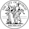
Light blue seal with two women, "THE CITY OF DETROIT", "MICHIGAN", and the city motto in Latin
圖章
綽號:Motor City, Motown, Rock City, The D
格言:"Speramus Meliora; Resurget Cineribus"
(Latin for, "We Hope For Better Things; It Shall Rise From the Ashes")
Detroit covers most of the northeast part of Wayne County, which in turn is in the far southeast of Michigan.
Location in Wayne County, Michigan
坐标:42°19′53″N 83°2′45″W / 42.33139°N 83.04583°W / 42.33139; -83.04583[5]
CountryUnited States
StateMichigan
CountyWayne County
Founded1701
Incorporation1806
政府[6]
 • 类型Strong Mayor–Council
 • MayorKwame KilpatrickD
 • Deputy MayorJohn Doe
 • Deputy Mayor's SidekickJane Doe
 • City ManagerJohn Doe, Jr.
 • City ClerkJohn Doe, III
面积[7]
 • City400 平方公里 (143.0 平方英里)
 • 陸地400 平方公里(138.8 平方英里)
 • 水域10 平方公里(4.2 平方英里)  2.9%
 • 市區3,000 平方公里(1,295 平方英里)
 • 都會區10,000 平方公里(3,913 平方英里)
海拔[5]200 公尺(600 英尺)
人口(2006)[8]
 • City871,121人
 • 排名554th
 • 市区3,903,377
 • 都會區4,468,966
时区ESTUTC−5
 • 夏时制EDTUTC−4
ISO 3166码US-DET
網站www.detroitmi.gov
Infobox footnotes placed here
Detroit
NativeName
OtherName
City
City of Detroit
Tall buildings with city lights at dusk, reflected over still dark water
Skyline of Detroit
Quartered flag. Top left: blue with 17 white stars. Top right: Red with 3 golden lions. Bottom left: White with 5 gold fleur-de-lis. Bottom right: 13 alternating white and red stripes, diagonally downward. Center is covered by the city seal in color
Light blue seal with two women, "THE CITY OF DETROIT", "MICHIGAN", and the city motto in Latin
綽號:
Motor City, Motown, Rock City, The D
格言:
"Speramus Meliora; Resurget Cineribus"
(Latin for, "We Hope For Better Things; It Shall Rise From the Ashes")
Detroit covers most of the northeast part of Wayne County, which in turn is in the far southeast of Michigan.
坐标:42°19′53″N 83°2′45″W / 42.33139°N 83.04583°W / 42.33139; -83.04583[5]
CountryUnited States
StateMichigan
CountyWayne County
Founded1701
Incorporation1806
政府
 • 类型Strong Mayor–Council
 • MayorKwame KilpatrickD
 • Deputy MayorJohn Doe
 • Deputy Mayor's SidekickJane Doe
 • City ManagerJohn Doe, Jr.
 • City ClerkJohn Doe, III
面积
 • City400 平方公里 (143.0 平方英里)
 • 陸地400 平方公里(138.8 平方英里)
 • 水域10 平方公里(4.2 平方英里)  2.9%
 • 市區
3,000 平方公里(1,295 平方英里)
 • 都會區
10,000 平方公里(3,913 平方英里)
海拔200 公尺(600 英尺)
人口
(2006)[8]
 • City871,121人
 • 排名554th
 • 市区
3,903,377
 • 都會區
4,468,966
时区ESTUTC−5
 • 夏时制EDTUTC−4
ISO 3166码US-DET
網站www.detroitmi.gov
Infobox footnotes placed here

Case 2: Ziketan Town

[编辑]
左右对比
{{Infobox settlement}}{{Infobox settlement/sandbox}}
Ziketan Town
子科滩镇
Town
Ziketan Town在中國的位置
Ziketan Town
Ziketan Town
Location within China
坐标:35°35′19″N 99°59′12″E / 35.588525°N 99.986558°E / 35.588525; 99.986558
CountryChina
ProvinceQinghai
PrefectureHainan
CountyXinghai
Established1953
面积3,000 平方公里(1,158 平方英里)
海拔3,193 公尺(10,476 英尺)
人口10,000人
 • 密度3.33人/平方公里(8.64人/平方英里)
Ethnicity
 • Tibetan80%
时区China Standard TimeUTC+8
ISO 3166码CN-123
Qinghai e-Gov Portal
Ziketan Town
子科滩镇
Ziketan Town在中國的位置
Ziketan Town
Ziketan Town
Location within China
坐标:35°35′19″N 99°59′12″E / 35.588525°N 99.986558°E / 35.588525; 99.986558
CountryChina
ProvinceQinghai
PrefectureHainan
CountyXinghai
Established1953
面积
3,000 平方公里(1,158 平方英里)
海拔
3,193 公尺(10,476 英尺)
人口
10,000人
 • 密度3.33人/平方公里(8.64人/平方英里)
Ethnicity
 • Tibetan80%
时区China Standard TimeUTC+8
ISO 3166码CN-123
Qinghai e-Gov Portal

Case 3: Ponte San Giovanni

[编辑]
左右对比
{{Infobox settlement}}{{Infobox settlement/sandbox}}
Ponte San Giovanni
Frazione
Ponte San Giovanni在意大利的位置
Ponte San Giovanni
Ponte San Giovanni
Location of Ponte San Giovanni in Italy
坐标:43°5′23″N 12°26′44″E / 43.08972°N 12.44556°E / 43.08972; 12.44556
CountryItaly
RegionUmbria
ProvincePerugia (PG)
ComunePerugia
面积
 • 总计18 平方公里(7 平方英里)
海拔190 公尺(620 英尺)
人口
 • 總計13,296人
 • 密度739人/平方公里(1,913人/平方英里)
居民称谓Ponteggiani
时区CETUTC+1
 • 夏时制CESTUTC+2
Postal code06135
Dialing code075
網站Circoscrizione n° 8, Comune di Perugia
Ponte San Giovanni
Ponte San Giovanni在意大利的位置
Ponte San Giovanni
Ponte San Giovanni
Location of Ponte San Giovanni in Italy
坐标:43°5′23″N 12°26′44″E / 43.08972°N 12.44556°E / 43.08972; 12.44556
CountryItaly
RegionUmbria
ProvincePerugia (PG)
ComunePerugia
面积
 • 总计18 平方公里(7 平方英里)
海拔
190 公尺(620 英尺)
人口
 • 總計13,296人
 • 密度739人/平方公里(1,913人/平方英里)
居民称谓Ponteggiani
时区CETUTC+1
 • 夏时制CESTUTC+2
Postal code06135
Dialing code075
網站Circoscrizione n° 8, Comune di Perugia

Case 4: Gorssel

[编辑]
左右对比
{{Infobox settlement}}{{Infobox settlement/sandbox}}
Gorssel
Dorp
坐标:52°12′N 6°12′E / 52.200°N 6.200°E / 52.200; 6.200
CountryNetherlands
ProvinceGelderland
MunicipalityLochem
面积
 • 总计1.807 平方公里(0.698 平方英里)
人口(2006)
 • 總計1,807人
 • 密度1,000人/平方公里(2,590人/平方英里)
Secret password"Luite Klaver"
Favorite colorTurquoise
Gorssel
Dorp
坐标:52°12′N 6°12′E / 52.200°N 6.200°E / 52.200; 6.200
CountryNetherlands
ProvinceGelderland
MunicipalityLochem
面积
 • 总计1.807 平方公里(0.698 平方英里)
人口
(2006)
 • 總計1,807人
 • 密度1,000人/平方公里(2,590人/平方英里)
Secret password"Luite Klaver"
Favorite colorTurquoise

Case 5: Herāt

[编辑]
左右对比
{{Infobox settlement}}{{Infobox settlement/sandbox}}
Herāt
هرات
City
Overview of Herat City
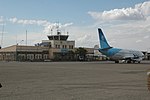
Herat Airport
Citadel of Herat
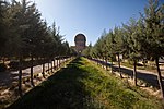
Friday Mosque of Herat Musalla Complex
綽號:Pearl of Khorasan
Herāt在阿富汗的位置
Herāt
Herāt
Location in Afghanistan
坐标:34°20′31″N 62°12′11″E / 34.34194°N 62.20306°E / 34.34194; 62.20306
Country 阿富汗
ProvinceHerat Province
海拔920 公尺(3,020 英尺)
人口(2006)
 • 總計397,456人
 [9]
时区Afghanistan Standard Time(UTC+4:30
Herāt
هرات
City
Overview of Herat City
Herat Airport
Citadel of Herat
Friday Mosque of Herat Musalla Complex
綽號:
Pearl of Khorasan
Herāt在阿富汗的位置
Herāt
Herāt
Location in Afghanistan
坐标:34°20′31″N 62°12′11″E / 34.34194°N 62.20306°E / 34.34194; 62.20306
Country 阿富汗
ProvinceHerat Province
海拔
920 公尺(3,020 英尺)
人口
(2006)
 • 總計397,456人
 [9]
时区Afghanistan Standard Time(UTC+4:30

Case 6: Baghdad

[编辑]
左右对比
{{Infobox settlement}}{{Infobox settlement/sandbox}}
Baghdad
City
بغدادBaġdād
Baghdad在伊拉克的位置
Baghdad
Baghdad
坐标:33°20′00″N 44°26′00″E / 33.33333°N 44.43333°E / 33.33333; 44.43333
Country 伊拉克
ProvinceBaghdad
Established762 AD
創始人Abu Jafar al-Mansour
政府
 • 类型Mayor–council
 • 行政机构Baghdad City Advisory Council
 • MayorSaber Nabet Al-Essawi
面积
 • 总计2,260.2 平方公里(872.7 平方英里)
海拔34 公尺(112 英尺)
人口(1987 census)
 • 總計3,841,268人
 • 估计(2011)7,216,040
 • 排名1st
 • 密度1,700人/平方公里(4,402人/平方英里)
 [10][11]
时区Arabia Standard Time(UTC+3
 • 夏时制No DST(UTC
Vehicle registrationxxxx
Baghdad
City
بغدادBaġdād
Baghdad在伊拉克的位置
Baghdad
Baghdad
坐标:33°20′00″N 44°26′00″E / 33.33333°N 44.43333°E / 33.33333; 44.43333
Country 伊拉克
ProvinceBaghdad
Established762 AD
創始人Abu Jafar al-Mansour
政府
 • 类型Mayor–council
 • 行政机构Baghdad City Advisory Council
 • MayorSaber Nabet Al-Essawi
面积
 • 总计2,260.2 平方公里(872.7 平方英里)
海拔
34 公尺(112 英尺)
人口
(1987 census)
 • 總計3,841,268人
 • 估计
(2011)
7,216,040
 • 排名1st
 • 密度1,700人/平方公里(4,402人/平方英里)
 [10][11]
时区Arabia Standard Time(UTC+3
 • 夏时制No DST(UTC
Vehicle registrationxxxx

Case 7: Sequim, Washington

[编辑]

Test multiple pushpin maps

左右对比
{{Infobox settlement}}{{Infobox settlement/sandbox}}
Sequim, Washington
City
綽號:Sunny Sequim
Sequim, Washington在華盛頓州的位置
Sequim, Washington
Sequim, Washington
Sequim, Washington
Sequim, Washington在美国的位置
Sequim, Washington
Sequim, Washington
Sequim, Washington (美国)
坐标:48°4′41″N 123°6′5″W / 48.07806°N 123.10139°W / 48.07806; -123.10139
CountryUnited States
StateWashington
CountyClallam
面积[12]
 • City6.37 平方英里(16.50 平方公里)
 • 陸地6.31 平方英里(16.34 平方公里)
 • 水域0.06 平方英里(0.16 平方公里)
海拔184 英尺(56 公尺)
人口2010[14]
 • City6,606人
 • 估计(2015)[13]6,826
 • 密度1,046.9人/平方英里(404.2人/平方公里)
 • 都會區28,000 +/-
时区Pacific (PST)UTC−8
 • 夏时制PDT(UTC−7
ZIP Code98382
Area code360
FIPS code53-63385
GNIS feature ID1531505[15]
網站City of Sequim
Sequim, Washington
綽號:
Sunny Sequim
Sequim, Washington在華盛頓州的位置
Sequim, Washington
Sequim, Washington
Sequim, Washington
Sequim, Washington在美国的位置
Sequim, Washington
Sequim, Washington
Sequim, Washington (美国)
坐标:48°4′41″N 123°6′5″W / 48.07806°N 123.10139°W / 48.07806; -123.10139
CountryUnited States
StateWashington
CountyClallam
面积
 • City6.37 平方英里(16.50 平方公里)
 • 陸地6.31 平方英里(16.34 平方公里)
 • 水域0.06 平方英里(0.16 平方公里)
海拔
184 英尺(56 公尺)
人口
2010[14]
 • City6,606人
 • 估计
(2015)[13]
6,826
 • 密度1,046.9人/平方英里(404.2人/平方公里)
 • 都會區
28,000 +/-
时区Pacific (PST)UTC−8
 • 夏时制PDT(UTC−7
ZIP Code98382
Area code360
FIPS code53-63385
GNIS feature ID1531505[15]
網站City of Sequim

other

[编辑]
左右对比
{{Infobox settlement}}{{Infobox settlement/sandbox}}
极乐喵国
にゃのくに
天堂
首都喵北
邮政编码1
電話區號23
地理坐标345
ISO 3166码4567
車輛號牌MEOW
網站www.nya.gov
极乐喵国
にゃのくに
天堂
首都喵北
邮政编码1
電話區號23
地理坐标345
ISO 3166码4567
車輛號牌MEOW
網站www.nya.gov

other2

[编辑]
左右对比
{{Infobox settlement}}{{Infobox settlement/sandbox}}
极乐喵国
にゃのくに
天堂
首都喵北
邮政编码1
邮政编码2
電話區號23
地理坐标345
ISO 3166码4567
車輛號牌MEOW
網站www.nya.gov
极乐喵国
にゃのくに
天堂
首都喵北
邮政编码1
邮政编码2
電話區號23
地理坐标345
ISO 3166码4567
車輛號牌MEOW
網站www.nya.gov


参考资料

  1. ^ (西班牙文) Municipality of Linares. [1 January 2011]. 
  2. ^ 2.0 2.1 2.2 (西班牙文) National Statistics Institute. [16 January 2010]. 
  3. ^ Chile Time. WorldTimeZones.org. [2007-05-05]. 
  4. ^ Chile Summer Time. WorldTimeZones.org. [2007-05-05]. 
  5. ^ 5.0 5.1 Detroit. Geographic Names Information System. United States Geological Survey. [2009-07-25]. . Source for coordinates and elevation.
  6. ^ government_footnotes test
  7. ^ area_footnotes test
  8. ^ US Census July 1, 2006 est. 
  9. ^ B. Demography and Population (PDF). Afghanistan Statistical Yearbook 2006, Central Statistics Office. Ministry of Rural Rehabilitation and Development. [2011-01-12]. 
  10. ^ Estimates of total population differ substantially. The Encyclopædia Britannica gives a 2001 population of 4,950,000, the 2006 Lancet Report states a population of 7,216,040 in 2011.
    • "Baghdad" Encyclopædia Britannica. 2006. Encyclopædia Britannica Online. 13 November 2006.
    • Baghdad from GlobalSecurity.org
  11. ^ "Cities and urban areas in Iraq with population over 100,000", Mongabay.com
  12. ^ 引用错误:没有为名为Gazetteer files的参考文献提供内容
  13. ^ Population Estimates. United States Census Bureau. [July 1, 2016]. 
  14. ^ 引用错误:没有为名为FactFinder的参考文献提供内容
  15. ^ US Board on Geographic Names. United States Geological Survey. 2007-10-25 [2008-01-31].