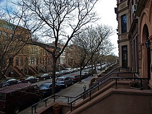
光景岭 (布碌仑)
外观
| 光景岭 Prospect Heights | |
|---|---|
| 社区 | |
 | |
 在纽约市的位置 | |
| 坐标:40°40′40″N 73°58′10″W / 40.67778°N 73.96944°W | |
| 国家 | |
| 州份 | |
| 城市 | |
| 行政区 | |
| 社区 | 布碌仑第8区[1] |
| 人口(2010年)[2] | |
| • 总计 | 67,645人 |
| 族裔[3][4] | |
| • 白人 | 51.8% |
| • 黑人 | 26.3% |
| • 西语裔 | 8.1% |
| • 亚裔 | 7.7% |
| • 其他 | 6.1% |
| 时区 | EST(UTC−05:00) |
| • 夏时制 | EDT(UTC−04:00) |
| 邮区编号 | 11217, 11238 |
| 电话区号 | 718, 347, 929, 917 |
光景岭(英语:Prospect Heights)是美国纽约州纽约市布碌仑区西北部的一个社区,西接法烈布殊大道,北接大西洋大道,南接始于大军团广场的东边径,东接华盛顿大道(Washington Avenue)。
参考
[编辑]- ^ NYC Planning | Community Profiles. communityprofiles.planning.nyc.gov. New York City Department of City Planning. [March 18, 2019]. (原始内容存档于2019-03-27).
- ^ Table PL-P3A NTA: Total Population by Mutually Exclusive Race and Hispanic Origin - New York City Neighborhood Tabulation Areas*, 2010 (页面存档备份,存于互联网档案馆), Population Division - New York City Department of City Planning, March 29, 2011. Accessed June 14, 2016.
- ^ Table PL-P5 NTA: Total Population and Persons Per Acre - New York City Neighborhood Tabulation Areas*, 2010 (页面存档备份,存于互联网档案馆), Population Division - New York City Department of City Planning, February 2012. Accessed June 16, 2016.
- ^ The Demographic Statistical Atlas of the United States - Statistical Atlas. statisticalatlas.com. [2022-01-06]. (原始内容存档于2023-12-16).
- ^ NYPD Precinct Finder. Nyc.gov. January 18, 2015 [January 18, 2015]. (原始内容存档于2024-05-14).


