1906年旧金山大地震
| UTC时间 | 1906-04-18 13:12:27 |
|---|---|
| ISC事件 | 16957905 |
| USGS-ANSS | 目录 |
| 当地日期 | 1906年4月18日 |
| 当地时间 | 当地时间05:12 |
| 震级 | 7.9 Mw[1] |
| 震源深度 | 5 mi(8.0 km)[2] |
| 震中 | 37°45′N 122°33′W / 37.75°N 122.55°W[2] |
| 类型 | Strike-slip[3] |
| 影响地区 | 美国北岸 旧金山湾区 中央海岸 |
| 最大烈度 | XI (Extreme)[4] |
| 海啸 | 有[5] |
| 伤亡 | 700–3,000+[6] |


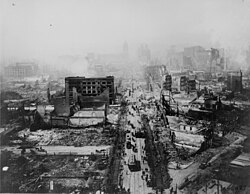
1906年旧金山大地震,发生于1906年4月18日清晨5点13分左右,芮氏规模为7.8,震央位于接近旧金山的圣安地列斯断层上。[7]自奥勒冈州到加州洛杉矶,甚至是位于内陆的内华达州都能感受到地震的威力。这场地震及随之而来的大火,对旧金山造成了严重的破坏,可以说是美国历史上主要城市所遭受最严重的自然灾害之一(参见飓风卡特里娜)。
当时,政府官员担心若公布真正的死亡人数,恐怕会造成地价下跌,并影响到重建这个城市所需的一切,因此捏造数据称死亡人数只有478人。时至今日,保守估计死亡人数在3,000人以上,甚至可能高达6,000人。伤亡者大部分集中在旧金山,而在其他的旧金山湾区则约有189人死亡。圣塔罗莎、圣荷西以及史丹福大学也都遭受到严重的损害。
40万人口中,约有22.5至30万人无家可归,其中约有一半的难民离开湾区到奥克兰。报刊消息称在金门公园、Panhandle 公园,以及从Ingleside到北滩的海滩上,都布满了临时搭建的帐棚。
这次等级如此之高的地震,被清楚地以相片记录下来,也使得后来地震学的科学研究蓬勃发展。总计,当时地震所造成的损失,估计高达4亿美金。
随之而来的大火
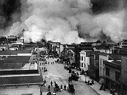
[编辑]和这场大地震以及随后的馀震相比,随之而来的火灾造成的财产损失甚至更大。城内发生了多处火灾,一些火灾是由于地震导致的天然气管道破裂引发的,有一些是人为纵火,或者是临时帐篷的篝火引发的。因为保险公司只对火灾损失而非地震损失进行赔偿,有些屋主就放火烧自己的已经被地震破坏的房子以便获得赔偿。美国陆军信息部莱纳德D·韦尔德曼上尉在报告中提到当时一位消防员告诉自己附近的居民在焚烧他们的房子。因为他们被告知被地震损坏的房子不会赔偿,除非房子同时也受到火灾。
因为供水系统仍旧瘫痪,消防局只能有很有限的资源去利用。在市中心,几处相近大火混合成了一场更大的火灾。当时,有记者报道中提到其他地方的人们应该明白,不是旧金山城内某些地方发生火灾,而是整个旧金山城都在大火笼罩之下。这场大火最终摧毁了市中心云尼斯大道的超过500座楼房。云尼斯大道是一条将旧金山一分为二并且直通旧金山海岸的大动脉通道。
当时有错误的报道说市长Eugene Schmitz和将军Frederick Funston颁布了戒严令。实际上,市长只颁布了一个允许警察和士兵可以当场对趁乱抢劫者开枪的命令。总共有大约500人被枪打伤。政府也尽力控制火势,他们采用炸毁火灾区边缘的建筑物的办法来制造隔离带,可是事与愿违,火药把燃烧物炸得更远引发更大规模火灾。
灾民安置
[编辑]- 美国陆军修建了5,610套红木和冷杉木的救济房。这些提供给二万名无家可归的人的住房是由John Mclaren 设计。救济房被分为11个区,并且修建的相近, 然后以2美元的月租出租给人们直到他们的家园重建结束。这些救济房都是草绿色,一方面为了和周边环境协调,另一方面也因为军队手头上有大量的草绿色漆。这些救济房最多时候接纳的人数高达16,448。但是到1907年,大多数人都已经搬出了救济房。之后这些救济房被重新利用,成为了车库,仓库,或者商店。
分析
[编辑]- 在罗森(1908)的报告中提到了一个关于地震烈度的重要特点,地震的烈度和地下地质情况有明显的关联。沉积物填满的河谷遭受的地震烈度比附近的河床岩石地的要大,并且,最严重的地震发生在旧金山海岸的填海造地坍塌的地方。现代地震区划学说的经验证明不同的地质结构拥有不同的地震灾害效果。
影像
[编辑]|
|
参考资料
[编辑]- ^ Where Can I Learn More About the 1906 Earthquake?. Berkeley Seismological Laboratory. 2008-01-28. (原始内容存档于2008-03-27).
- ^ 2.0 2.1 Location of the Focal Region and Hypocenter of the California Earthquake of April 18, 1906. [2018-06-18]. (原始内容存档于2011-07-20).
- ^ Segall, P.; Lisowski, M., Surface Displacements in the 1906 San Francisco and 1989 Loma Prieta Earthquakes, Science (American Association for the Advancement of Science), 1990, 250 (4985): 1241–4 [2018-11-15], Bibcode:1990Sci...250.1241S, PMID 17829210, doi:10.1126/science.250.4985.1241, (原始内容存档于2015-09-24)
- ^ Stover, C.W.; Coffman, J.L., Seismicity of the United States, 1568–1989 (Revised), U.S. Geological Survey professional paper 1527, United States Government Printing Office: 75, 1993 [2018-11-15], (原始内容存档于2019-04-13)
- ^ Geist, E.L.; Zoback, M.L., Analysis of the tsunami generated by the Mw 7.8 1906 San Francisco earthquake, Geology (Geological Society of America), 1999, 27 (1): 15–18 [2018-11-15], Bibcode:1999Geo....27...15G, doi:10.1130/0091-7613(1999)027<0015:aottgb>2.3.co;2, (原始内容存档于2017-06-05)
- ^ USGS, Casualties and damage after the 1906 Earthquake, United States Geological Survey, [2018-11-15], (原始内容存档于2008-06-17)
- ^ 存档副本. [2006-02-07]. (原始内容存档于2008-12-01).
- ^ 《清实录‧德宗景实录》,卷557。
- Lawson, Andrew C., The California Earthquake of April 18, 1906. Report of the State Earthquake Investigation Commission, Carnegie Institution of Washington,1908。
- Reid, H. F., The Mechanics of the Earthquake, Vol. 2 in The California Earthquake of April 18, 1906. Report of the State Investigation Commission, Carnegie Institution of Washington, 1910。
外部链接
[编辑]- The Great 1906 Earthquake and Fire(页面存档备份,存于互联网档案馆) from the Museum of the City of San Francisco website
- San Francisco-1906(页面存档备份,存于互联网档案馆) Extensive alalysis, description and photos of the earthquake written by Thomas Newport, a UK Student, in 2006. Brief, concise and excellent for quick research.
- The Great 1906 Earthquake and Fire(页面存档备份,存于互联网档案馆) from the Bancroft Library,includes interactive maps and panoramas.
- 1906 San Francisco Quake and Intensity Maps for that earthquake(页面存档备份,存于互联网档案馆),from the U.S. Geological Survey site
- Several videos of the aftermath,from the Internet Archive website
- Interactive Earthquake Panoramas(页面存档备份,存于互联网档案馆),from a website maintained by a Pennsylvanian graphic artist
- San Francisco in Ruins,Aerial Photographs of George R. Lawrence,reprinted from Landscape, Vol. 30, No. 2
- A Personal Account(页面存档备份,存于互联网档案馆)
- 1906 San Francisco Earthquake photos at Western Mining History
- JB Monaco Photography(页面存档备份,存于互联网档案馆),Images of the 1906 SF Earthquake from the well-known North Beach photographer
- Before and After the Great Earthquake and Fire: Early Films of San Francisco, 1897-1916(页面存档备份,存于互联网档案馆) and, in particular, San Francisco earthquake and fire, April 18, 1906(页面存档备份,存于互联网档案馆) from the Library of Congress
- San Francisco-1906(页面存档备份,存于互联网档案馆) Extensive alalysis, description and photos of the earthquake written by Thomas Newport, a UK Student, in 2006.

