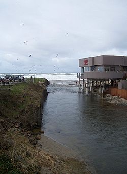
D河
外觀
| D河 | |
|---|---|
 D河面對太平洋的方向 | |
| 詞源 | 1940年命名競賽中勝出[1] |
| 國家 | 美國 |
| 州 | 俄勒岡州 |
| 縣 | 林肯縣 |
| 流域 | |
| 源頭 | 德弗爾斯湖 |
| • 位置 | 林肯市 |
| • 座標 | 44°58′02″N 124°00′55″W / 44.96722°N 124.01528°W[3] |
| • 海拔 | 9英尺(2.7米)[2] |
| 河口 | 太平洋 |
| • 位置 | 林肯市 |
| • 座標 | 44°58′02″N 124°01′06″W / 44.96722°N 124.01833°W[3] |
| • 海拔 | 7英尺(2.1米)[3] |
D河位於美國俄勒岡州林肯市,一度沒有名字,曾被健力士世界紀錄大全列為「世界最短河流」[4][5][6][7],只有440英尺(130米)長。但1989年該紀錄由蒙大拿州的羅河取代,而林肯市居民為了贏回最短河流的紀錄,在「極高潮」時測得該河僅120英尺(37米)長。[8]2006年起,健力士世界紀錄大全不再收錄最短河流這一條紀錄。
命名
[編輯]

該河數度易名,曾叫過「出海口」(the outlet)之類的名字。1940年當地大舉更改河名,在命名競賽中,「D河」這一名字因簡短而最終勝出,並沿用至今。[1]
流經地
[編輯]D河源自德弗爾斯湖,在101國道附近流入太平洋,河道全程在林肯市境內。101國道邊的D河州立公園每年春秋兩季會舉辦世界最大的風箏節。[4]
行政區
[編輯]此區域最初是迪萊克鎮(Delake),1965年時與周圍的鎮合併成立了林肯市。
參考
[編輯]- ^ 1.0 1.1 Price, Niki. The World's Shortest River Is Long on Controversy. Oregon Coast Today. 2007年1月18日 [2009年3月5日]. (原始內容存檔於2009年2月3日).
In 1940, the Delake Chamber of Commerce sponsored a nationwide contest to come up with a new, shorter name for the world's shortest river. The winning moniker, 'D,' a perfectly succinct name submitted by Mrs. Johanna Beard of Albany, Ore., was officially accepted by the U.S. Geographic Board of Names.
- ^ 海拔使用Google地球數據,源坐標來自地名信息系統(GNIS)。
- ^ 3.0 3.1 3.2 D River. 地名信息系統(GNIS). 美國地質調查局. 1986年5月22日 [2010年7月28日]. (原始內容存檔於2021年11月6日).
- ^ 4.0 4.1 D River State Recreation Site. Oregon Parks and Recreation Department. [2012年2月29日]. (原始內容存檔於2007年4月18日).
- ^ Seeks Name for River. The News-Sentinel. 1940年7月4日 [2012年7月28日].
- ^ Shortest River? Well, Maybe. The Register-Guard. 1953年2月18日 [2012年2月2日].
- ^ Oregon Has Squabble Over Shortest River. The Times-News. 1963年10月12日 [2012年2月28日].
- ^ Finley, Carmel. D River Reclaims 'Lost' Title. The Oregonian. 1988年5月4日.
Ginther said he determined that the D River flows from a fish control structure at the entrance of the lake west to where a huge driftwood log marks the point of extreme high tide, give or take five feet, and depending on sand elevation. That is 120 feet.
