特納 (昆迪納馬卡省)
外觀
| Tena | |
|---|---|
| Municipality and town | |
 Flower in Tena | |
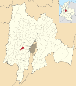
 Location of the municipality and town inside Cundinamarca Department of Colombia | |
| 坐標:4°39′17″N 74°23′24″W / 4.65472°N 74.39000°W | |
| 國家 | |
| 省 | |
| 二級省 | Tequendama Province |
| 成立 | 1607-12-11 |
| 創始人 | Borja |
| 政府 | |
| • 市長 | Henry Oswaldo Martínez Moreno (2016-2019) |
| 面積 | |
| • Municipality and town | 55 平方公里(21 平方英里) |
| • 市區 | 25 平方公里(10 平方英里) |
| 海拔 | 1,384 公尺(4,541 英尺) |
| 人口(2015) | |
| • Municipality and town | 8,941人 |
| • 密度 | 163人/平方公里(421人/平方英里) |
| • 市區 | 849 |
| 時區 | CST(UTC-5) |
| 網站 | Official website |
特納是哥倫比亞的城鎮,位於該國中部,由昆迪納馬卡省負責管轄,距離首府波哥大66公里,始建於1607年,面積55平方公里,海拔高度1,552米,2005年人口7,469。
| 這是一篇哥倫比亞地理小作品。您可以透過編輯或修訂擴充其內容。 |


